


If you’ve ever wandered around a busy warehouse at 2 a.m. and watched a big, quiet robot glide past a forklift driver without missing a beat, you’ve probably wondered how it does that—especially when stuff in the space changes on a daily basis. That robot’s an AMR (Autonomous Mobile Robot), and the secret to its smooth, no-collision moves isn’t just super advanced sensors; it’s how it updates its map when everything around it shifts, moves, or gets rearranged. As the head of an AMR system supplier, I see this question all the time from warehouse managers, forklift operators, and anyone trying to wrap their head around why these little (or big) robots don’t crash into random pallets or new shelving. Let’s break down how AMRs update their mapping—no jargon, just real stuff that works in the messy, ever-changing world of a working warehouse.
First, let’s get one thing straight: AMRs aren’t old AGVs (Automated Guided Vehicles) that follow fixed wires or tape on the floor. Old AGVs, like the ones you’ll see at places for heavy lifting or moving full pallets, need a totally new map if you so much as move a single shelf. But AMRs? They’re built to handle change, because their mapping system is two-faced: it has a master map of the whole space, but it’s also constantly scanning and checking for small, day-to-day changes. That’s the foundation of how they roll.
So, what’s the first step when an AMR “sees” something new? It uses a mix of sensors that are way more detailed than your phone’s camera. Most AMRs have LiDAR (that spinning thing on top that shoots millions of laser beams a second), cameras, and ultrasonic sensors that ping for objects close by. When an AMR is moving, it’s not just following a pre-programmed path—it’s taking constant “snapshots” of its surroundings, comparing them to the master map it was given when it first got set up. If there’s a spot where the snapshot doesn’t match the master map, it doesn’t freak out—it flags that as a possible change and decides whether to update or just adjust.
Let’s use a real warehouse example to make this concrete. Suppose you’re a warehouse that uses a [Forklift Automated Guided Vehicle] to move stacked pallets, but last week, you rearranged a row of shelving to make more space for bulk stock. When your AMRs start their morning routes, their LiDAR will scan that new shelving and notice the original map had empty space there, but now there’s a solid wall of metal. The AMR doesn’t stop and wait for a human to fix it—it uses a process called SLAM (Simultaneous Localization and Mapping) to figure out exactly where it is and how that new shelving fits into the map. SLAM is the workhorse here, and it’s the reason AMRs don’t need to be re-taught the whole space every time you make a small change.
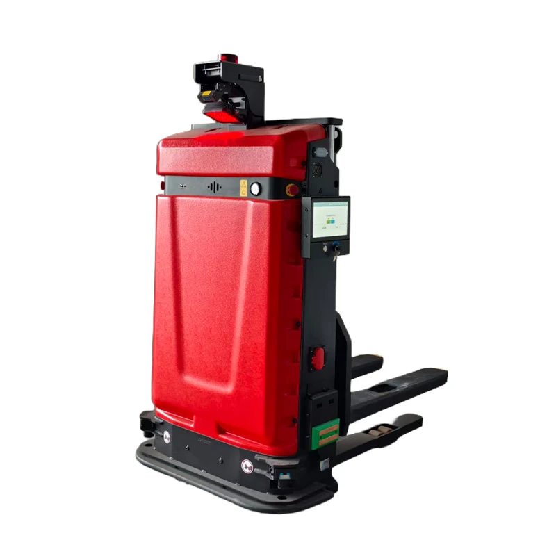

But not all changes are the same, so AMRs have different rules for updating their map based on how big or important the change is. Small, temporary stuff—like a pallet that’s sitting in the middle of a loading dock for an hour—doesn’t get added to the master map. AMRs are programmed to treat temporary obstacles (like a random dolly or a worker’s jacket left on a pallet) as “dynamic” and just go around them, using real-time pathfinding instead of updating the main map. That’s a huge difference from old AGVs, which would stop dead if they saw anything not on their fixed path.
Big, permanent changes? That’s when the AMR will actually update the master map. For example, if you invested in a [Heavy Load Automated Guided Vehicle] to move 10,000-pound machinery, you might clear out a whole new section of the warehouse for that equipment. When the AMRs that handle the new heavy loads start navigating that section, their sensor data will show that area used to be used for storing smaller boxes, so the system will flag that area as needing an update. The AMRs will then run a “map merge” process: they’ll take the new sensor data from the cleared section and combine it with the old master map, adjusting for any tiny positioning errors (like if the AMR’s wheels slipped a little while scanning) so the new map is accurate.
Another example: if you’re using [Unit Load Automated Guided Vehicle]s to move individual pallets, and you move a whole rack of frozen food to a different part of the freezer to keep closer to the loading door. The AMRs that service the freezer will scan the new rack positions over a couple of runs, compare that data to the old map, and once they confirm the new positions are consistent (no weird shifts from cold temperatures warping the floor), they’ll update the master map. This way, all AMRs—even ones that don’t go into the freezer every day—know where the frozen racks are, so they don’t try to pull a pallet from a spot that’s no longer there.
Wait, what about shared spaces? A lot of warehouses have AMRs, human workers, and forklifts all moving around at the same time. That’s where another layer of mapping update comes in: cooperative perception. AMRs can talk to each other (via Wi-Fi or a local network) to share what they’re seeing. If one AMR runs into a new stack of pallets by the shipping door that wasn’t there yesterday, it will send that data to every other AMR in the fleet, so they don’t all have to scan that same spot again. That’s a game-changer for busy warehouses because it cuts down on the time each AMR spends processing new data, so they can keep moving without slowing down.
Let’s talk about how that works with [Automated Guided Transport Vehicle]s, which are often used to move parts between a production line and a warehouse. Suppose the production line adds a new station, so the [Towing Automated Guided Vehicle System] that moves parts to the line has to take a new path around the station’s loading area. The first time that towing AMR takes the new path, it logs all the new landmarks (conveyor belts, new posts, the edge of the new station) and compares them to the master map. If the data lines up, the system will add that path to the fleet’s map, and all other towing AMRs will start using it too—no need to program each one individually.
Now, there’s a common misconception: people think AMRs just update their map automatically in real time, no human help at all. But that’s not true. While most small, routine changes are handled by the fleet, bigger changes—like expanding the warehouse or moving entire rows of shelving—need a quick human check. Our system, for example, has a simple web dashboard that lets warehouse managers review proposed map updates before they get locked in. Why? Because if an AMR thinks a random pile of empty boxes is a new permanent rack, we don’t want to update the map and make the robot drive into a pile of boxes tomorrow. That human-in-the-loop step is a critical check that keeps the whole system reliable.
Also, AMRs learn from their own mistakes, in a way. If an AMR keeps trying to drive through a spot where a worker has set up a temporary tent for inventory counting, it’ll notice it keeps getting a “no-go” signal from other AMRs or from the fleet’s server, so it will update its own pathfinding settings to avoid that spot without needing a full map update. That’s why you might see one AMR take a slightly different path than another for a day or two, until the system confirms the temporary obstacle is gone or permanent.
Let’s get into the tech a little, but keep it real—no fancy acronyms without explaining them. The core tech that makes this all work is called simultaneous localization and mapping (SLAM), like I mentioned earlier. When an AMR starts moving, SLAM uses its LiDAR, cameras, and wheels’ odometers (the thing that tracks how many times the wheels turn) to figure out exactly where it is in the warehouse, and at the same time, it builds (or updates) the map of the space. It’s like building a puzzle while you’re still putting the pieces together, and if a piece is missing or shifted, it adjusts to make the whole puzzle make sense.
But SLAM isn’t perfect on its own, especially in really dynamic spaces. That’s why we add what’s called “visual odometry” with cameras. If the LiDAR gets confused by a shiny new floor or a mirror that bounces laser beams, the cameras can pick up small visual cues—like a scratch on a wall, a specific logo on a pallet, or even a stain on the floor—that the LiDAR misses. That extra layer helps the AMR correct its position and update the map without getting lost.
Another thing that helps: our system lets AMRs store “anchor points” in the map. Anchor points are unique, unchanging things like support pillars, fixed conveyor belts, or the edge of a loading dock. When an AMR scans a new object, it compares it to these anchor points to make sure it’s not updating the map with something that’s not actually there. For example, if a new shelving unit is 2 feet away from a support pillar that’s an anchor point, the AMR will confirm that distance before adding the shelving to the master map. No anchor points, and an AMR might think a new pallet is a whole new section of shelving.
Now, let’s talk about what happens when a map update goes wrong. It’s rare, but it does happen. Usually, it’s because the space changed so fast that the AMR didn’t get a chance to scan the old version. Like, if a crew moves a whole rack in 10 minutes, and the AMR was in the middle of a scan when that happened, it might have half the old data and half the new data. That’s why our system has “scan retries”—if an AMR notices a discrepancy between its scan and the master map that’s too big, it will stop, scan the area again from a new angle, and ask the fleet server for help figuring out if the change is real or a glitch. We’ve seen this prevent a few awkward crashes in warehouses where crews are moving stuff last minute before a big shipment.
So, putting all this together, how do AMRs update their mapping when the environment changes? It’s a four-step process: First, they scan their surroundings in real time, using LiDAR, cameras, and their whole sensor suite. Second, they compare that scan to the master map, flagging any spots where things don’t match. Third, they decide if the change is temporary (so they just go around it) or permanent (so they update the map, either alone or with the fleet). Fourth, if it’s a big permanent change, they check with the human dashboard to make sure the update is correct before locking it in. As an AMR system supplier, we’ve spent years tweaking this process because we know warehouses aren’t static—they’re places where pallets get moved, shelves get rearranged, and new stuff gets added every single day.
If you’re running a warehouse and tired of AGVs that crash when you move a pallet, or having to re-program every route every time you make a small change, our AMR systems are built to handle that. We’ve worked with all kinds of warehouses—from small facilities moving individual pallets to big distribution centers moving heavy equipment—and our mapping update tech keeps everything running smooth, even when the space around you changes. If you’re ready to stop dealing with rigid, old automated guided vehicles and switch to a system that grows with your warehouse, we can walk you through how it works for your specific needs.
References
- Thrun, S. (2002). Robotic mapping: A survey. Artificial Intelligence and Mobile Robots, 1-35.
- Cadena, C., Carlone, L., Carrillo, H., Latif, Y., Scaramuzza, D., Neira, J., Reid, I., & Leonard, J. J. (2016). Past, present, and future of simultaneous localization and mapping: Toward the robust-perception age. IEEE Transactions on Robotics, 32(6), 1309-1332.
- Borenstein, J., Everett, H. R., & Feng, L. (1996). Navigating Mobile Robots: Systems and Techniques. A K Peters, Ltd.
- Kim, A., & Sukhatme, G. S. (2013). Improving grid-based occupancy maps using visual SLAM in dynamic environments. Proceedings of the IEEE International Conference on Robotics and Automation, 5351-5358.


